Planning your expedition to one of the wonders of the world can be overwhelming. Many travelers feel lost not knowing exactly where they will walk or what challenges they will face in the Andean mountains.
The best way to calm that anxiety and organize your adventure is by studying a good Inca Trail map. With this visual tool, you will transform uncertainty into pure excitement and be mentally ready for the challenge.
In this guide, we will break down each section of the journey so you know exactly what to expect on your grand trip to the mythical citadel of the Incas.
How to interpret the Inca Trail map?
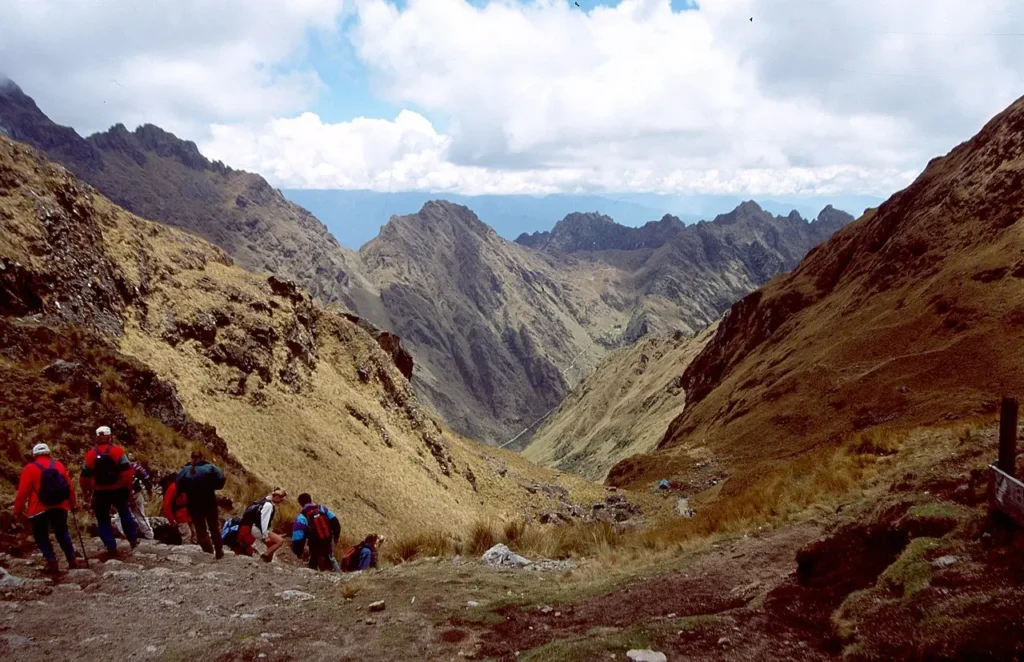
Understanding the Inca Trail to Machu Picchu map is the first step for a successful expedition. It is not just a straight line on a plane, but a constant ascent and descent through the rugged geography of the mountain range.
When looking at the Inca Trail route map, you will notice that the classic journey covers approximately 43 kilometers of stone-paved paths. The adventure begins at the famous Km 82 of the railway and culminates at the iconic Sun Gate.
To better plan your physical effort, it is essential to check the Inca Trail distance map. Each day has a different mileage and slope, with the second day being the most demanding due to the sudden gain in altitude.
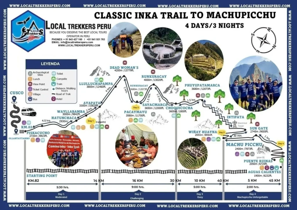
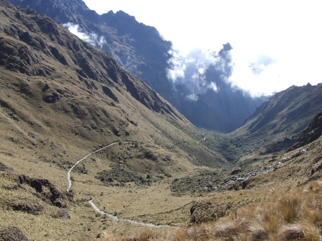
Detail of the Inca Trail stages map
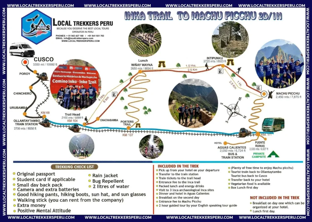
Analyzing the Inca Trail stages map allows you to visualize the campsites and the impressive archaeological sites you will cross. The traditional Inca Trail trek map is strategically divided into 4 days and 3 nights.
- Day 1 (Km 82 to Wayllabamba): A gentle start through green valleys, ideal for warming up and testing your boots.
- Day 2 (Wayllabamba to Pacaymayo): The biggest challenge of the trek. You will cross the feared Dead Woman’s Pass at over 4,200 meters high.
- Day 3 (Pacaymayo to Wiñay Wayna): The longest but visually beautiful day, entering fully into the humid cloud forest.
- Day 4 (Wiñay Wayna to Machu Picchu): A short early-morning hike to achieve the triumphant arrival at dawn.
Reviewing your Inca Trail route map in your tent before sleeping will help you visualize and mentally prepare for the next day’s stretch.
Essential Data on the Inca Trail Circuit Map
Any good Inca Trail trek map must be complemented with vital information about the natural environment. Here are the technical facts you must master before packing your backpack:
- Maximum Altitude: 4,215 m.a.s.l. (Warmiwañusca Pass or Dead Woman’s Pass).
- Weather: Highly varied. Intense cold at the high campsites at night (down to -5°C) and warm/humid weather in the cloud forest (25°C).
- Best Season: May to October (dry season). You will avoid heavy rains, and the stone paths will be safer.
- Difficulty: Moderate to Challenging. You don’t need to be an athlete, but it does require good cardiovascular endurance and leg strength.
- Mandatory items: Trekking boots (broken-in), layered clothing, waterproof poncho, trekking poles with rubber tips, and mosquito repellent.
Knowing these details in depth will help you navigate the Inca Trail route map with total safety and without logistical setbacks.
Expert Local Tips for Your Trekking
At Local Trekkers Peru, we have guided thousands of travelers through these trails. To ensure the Inca Trail route map is an enjoyable experience rather than one of suffering, we leave you our best tips:
- Mandatory Acclimatization: Arrive in Cusco (3,400 m.a.s.l.) at least 2 or 3 days before starting the walk. Your body needs time to adapt to the lack of oxygen.
- Take care of your knees: The long descents down the Inca stone staircases can be punishing. Use your trekking poles at all times to cushion the impact.
- Walk at your own pace: This is not a race. Breathe deeply, take short breaks for water, and trust our guides—they set the ideal pace.
- Permits in advance: Entry to this route is strictly controlled by the government. Spots sell out up to 6 months in advance.
Conclusion
Studying and understanding the Inca Trail map is your biggest advantage before putting on your hiking boots. Knowing the distances, altitudes, and campsites will give you the mental confidence needed to enjoy every step.
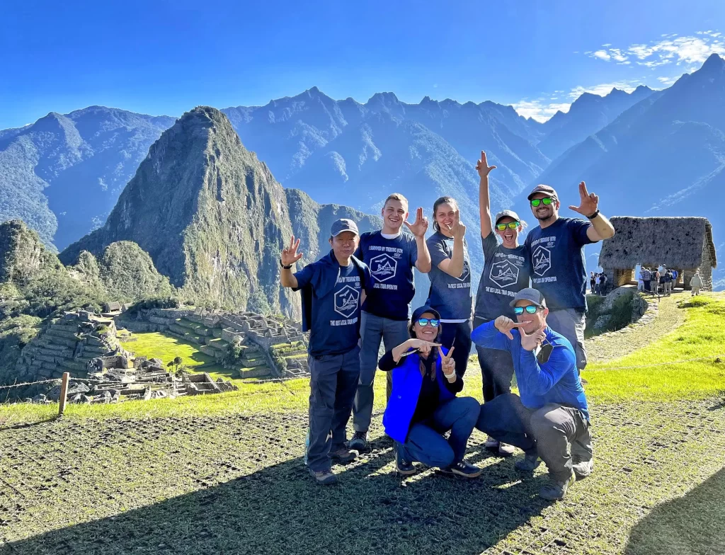
This historic route will test you physically and mentally, but the reward of seeing the citadel appear among the mountains at dawn is incomparable.
Are you ready to make history in the Andes? At Local Trekkers Peru, we handle all the complex logistics, permits, and equipment so you can focus only on walking. [Click here to view our Inca Trail packages] and contact us today to secure your spot.
No comments:
Post a Comment