Machu Picchu is on everyone’s bucket list, but the journey to get there is just as legendary as the destination itself. If you are planning this once-in-a-lifetime adventure, understanding the specific Inca Trail location is the first step in turning your dream into a reality.
While most travelers know the trek takes place in the Andes, many are surprised by the diverse geography covered along the way. From arid Andean valleys to the lush cloud forest, knowing exactly where does the Inca Trail start and where it ends will help you prepare mentally and physically.
In this guide, Local Trekkers Peru breaks down the geographical details, the Inca Trail trekking route Peru, and what you can expect from the terrain on this ancient path.
Understanding the Inca Trail Location and Geography
Geographically, the classic Inca Trail is located in the Cusco region of southern Peru. It winds through the majestic Andes Mountains, specifically connecting the Sacred Valley of the Incas to the Amazonian cloud forest where Machu Picchu is hidden.
The Inca Trail route to Machu Picchu is not just a straight line; it is a historic network of stone paths laid by the Incas centuries ago. Because of its protected status as a UNESCO World Heritage site and part of the Historic Sanctuary of Machu Picchu, the route is heavily regulated to preserve its integrity.

Where Does the Inca Trail Start? The Famous KM 82
So, where does the Inca Trail start exactly?
The official starting point of the Inca Trail is known as KM 82. This location is named after the marker at the 82nd kilometer along the railway tracks leading from Cusco to Aguas Calientes.
Here are the key details about the start:
- Location Name: Piscacucho (commonly referred to as KM 82).
- Altitude: Approximately 2,600 meters (8,530 feet).
- The Experience: This is where the KM 82 Inca Trail starting point checkpoint is located. You will present your passport and permit here. Once you cross the suspension bridge over the Urubamba River, your adventure officially begins.
Note: Some longer variations of the trek may start at KM 88, but the standard classic Inca Trail route details almost always focus on KM 82 as the beginning.
Inca Trail Itinerary Overview: The Path in Between
Between the start and the finish, the Inca Trail distance and route cover roughly 43 kilometers (26 miles). While that might not sound like a huge distance, the steep vertical gain and high altitude make it a challenging feat.
If you look at an Inca Trail route map, you will see the path snakes southward and then west, crossing high mountain passes before descending into the jungle.
Key Landmarks on the Route:
- Wayllabamba: The last inhabited village and usual campsite for Day 1.
- Dead Woman’s Pass (Warmiwañusca): The highest point of the trek at 4,215m (13,828 ft).
- Phuyupatamarca: Known as the “Town in the Clouds,” offering spectacular views.
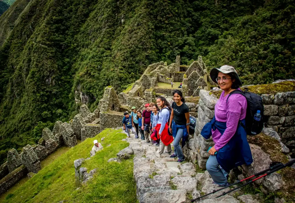
- Wiñay Wayna: The most stunning archaeological site on the trail before Machu Picchu.
Where Does the Inca Trail End? The Sun Gate
After four days of hiking, where does the Inca Trail end?
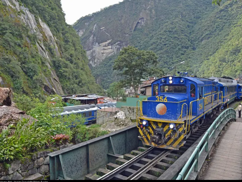
Unlike the train travelers who arrive at the town of Aguas Calientes (Machu Picchu Pueblo), trekkers have the exclusive privilege of arriving directly at the citadel from above.
The official ending point of the Inca Trail is the Inti Punku (Sun Gate).
- The Moment: Arriving at the Sun Gate is emotional. From here, you get your first panoramic view of Machu Picchu spread out below you.
- The Final Stretch: From the Sun Gate, it is a short, downhill walk (about 45 minutes) to the Guardhouse, where you capture that classic postcard photo of the ruins.

Quick Facts: How Long is the Inca Trail and What to Expect
To help you prepare, here is a summary of the technical data regarding the Inca Trail location and difficulty:
| Feature | Detail |
| Total Distance | 43 km / 26 miles |
| Duration | 4 Days / 3 Nights (Classic Route) |
| Starting Elevation | 2,600m (8,530 ft) – KM 82 |
| Max Elevation | 4,215m (13,828 ft) – Dead Woman’s Pass |
| Ending Elevation | 2,430m (7,972 ft) – Machu Picchu |
| Difficulty | Moderate to Challenging |
| Best Time to Go | May to September (Dry Season) |
Common Question: How long is the Inca Trail? While the classic trek is 4 days, there is also a “Short Inca Trail” option (2 days) that starts at KM 104.
Expert Tips from Local Trekkers Peru
As local experts, we know that knowing the map isn’t enough. Here are our top tips for mastering the Inca Trail trekking route Peru:
- Acclimatize in Cusco: Do not head to the starting point of the Inca Trail immediately upon landing in Peru. Spend at least 2 to 3 days in Cusco or the Sacred Valley to adjust to the altitude.
- Book 6 Months in Advance: Permits are limited to 500 per day (including porters and guides). If you want specific dates, you must book early.
- Prepare for “Inca Flat”: Guides often joke about the trail being “Inca Flat.” This usually means rolling hills that are rarely actually flat. Train your legs for stairs!
- Respect the Porters: They are the heroes of the trail. At Local Trekkers Peru, we treat our team like family, ensuring fair pay and proper gear. Always yield the way to porters on the trail.
Conclusion
The Inca Trail location offers one of the most diverse hiking experiences on the planet. From the dry scrub at KM 82 to the misty cloud forest at the Sun Gate, every step connects you to the history of the Andean people.
Knowing where does the Inca Trail start and end is just the beginning of your planning. Now that you understand the route, it’s time to secure your spot on this legendary path.
No comments:
Post a Comment